Comparison
Image
Size vs. Information
Centimeter
Level
Meter Level
Atmospheric
Effects

Comparison of Imagery from SPOT and CORONA Dimona Nuclear Facility in Israel September, 1971 |

1, 2 and 3 meter resolution of the White House |

80, 30, 20 and 10 meter resolution |
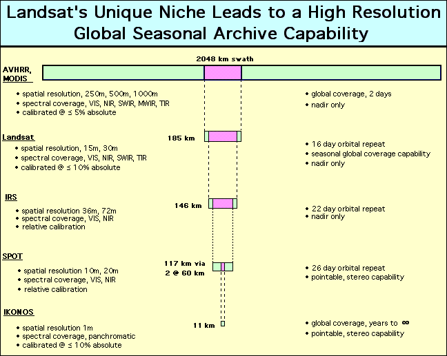
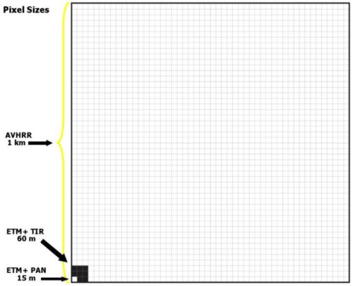
Pixel Dimension Graphics 1 | 2 | 3

Military Reconnaissance
High Resolution
Imagery
Corona
Russian
Spin 2 (Great Pyramids)

No, the government can't read license plate numbers or newspaper headlines from space. The laws of Atmospheric Optics make it essentially impossible to get better than 6 inch resolution from space and even that is pushing it in good conditions!